Passive Microwave Satellite Short Course
1. Which of these satellite products are made from microwave data?
Total Precipitable Water (TPW)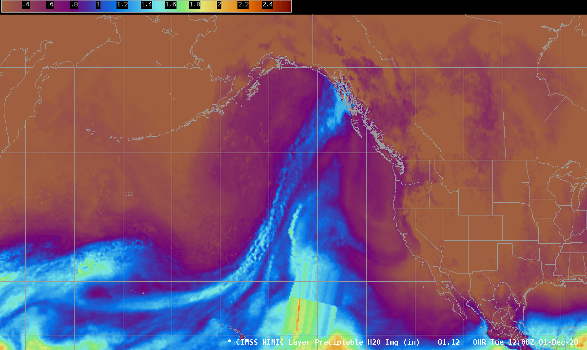 |
Wind Speed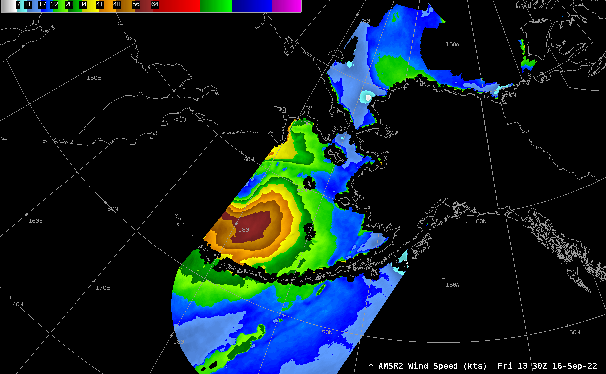 |
Rain Rate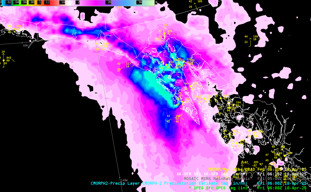 |
Water Vapor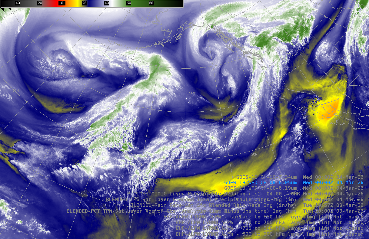 |
Microwave emissions from the earth are very weak which requires sensors to have a larger field of view and be at lower altitudes. This is the reason passive microwave sensors are only installed on LEO satellites. With Direct Broadcast microwave products can be available to the user within 15 minutes of the satellite passing overhead.
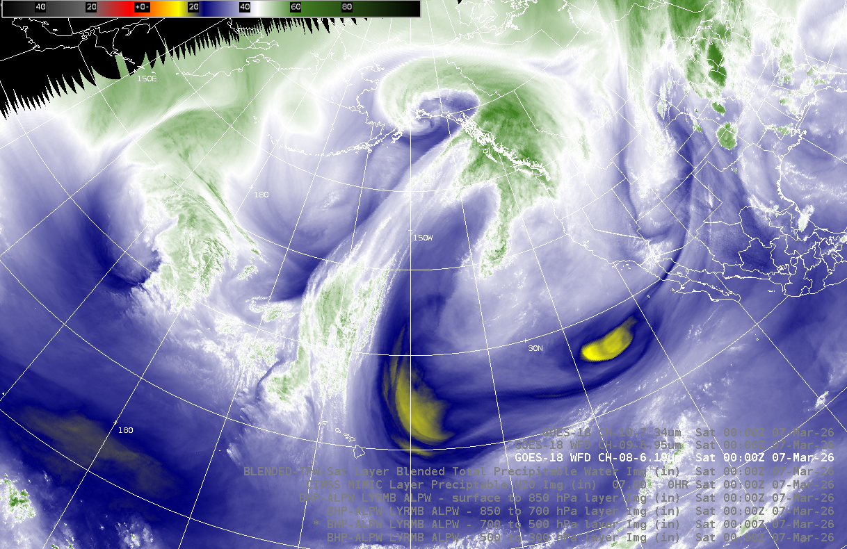
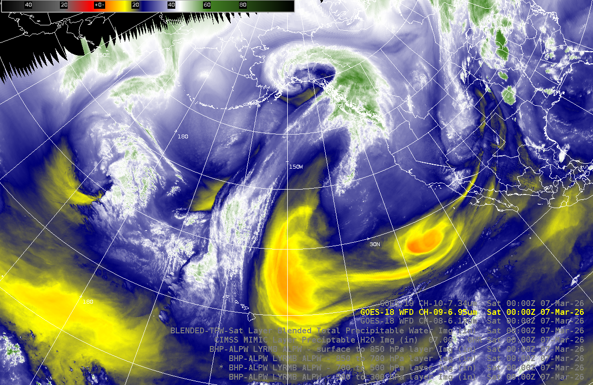
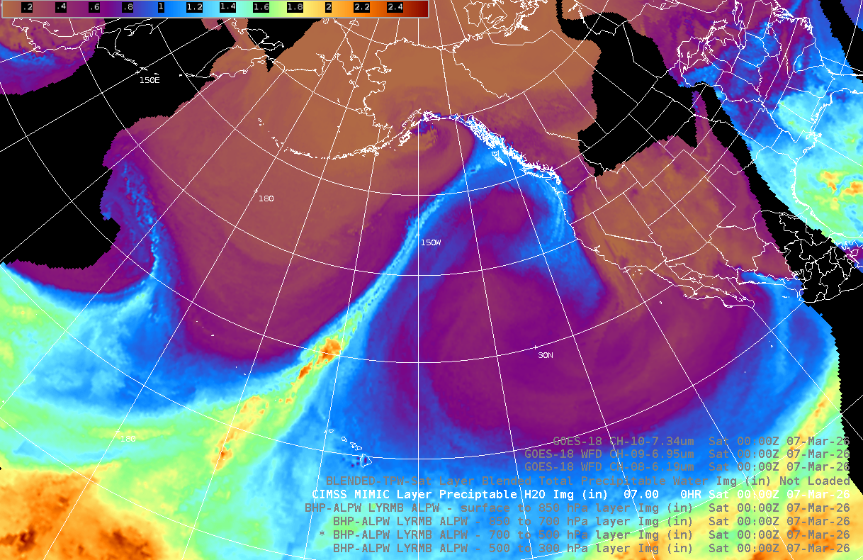
GOES Water Vapor Bands and Total Precipitable Water
Water Vapor bands help to identify jet streams, building ridges, and digging troughs but dense higher clouds obstruct lower altitude moisture features. TPW provides liquid water conent in the total atmospheric column more clearly identifying moisture plumes and tropical connections for features like Atmospheric Rivers.
2. From either of the TPW products above where is the strongest moisture plume in the northeast Pacifc?
- A. From the tropics to British Columbia
- B. From the tropics to southern Southeast Alaska and northern British Columbia.
- C. From the Gulf of Alaska to Southeast Alaska
- D. From the tropics to northern Southeast Alaska.
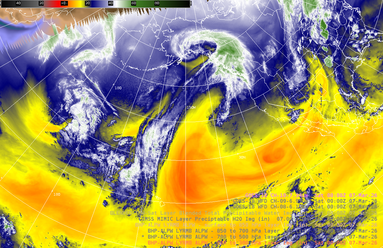
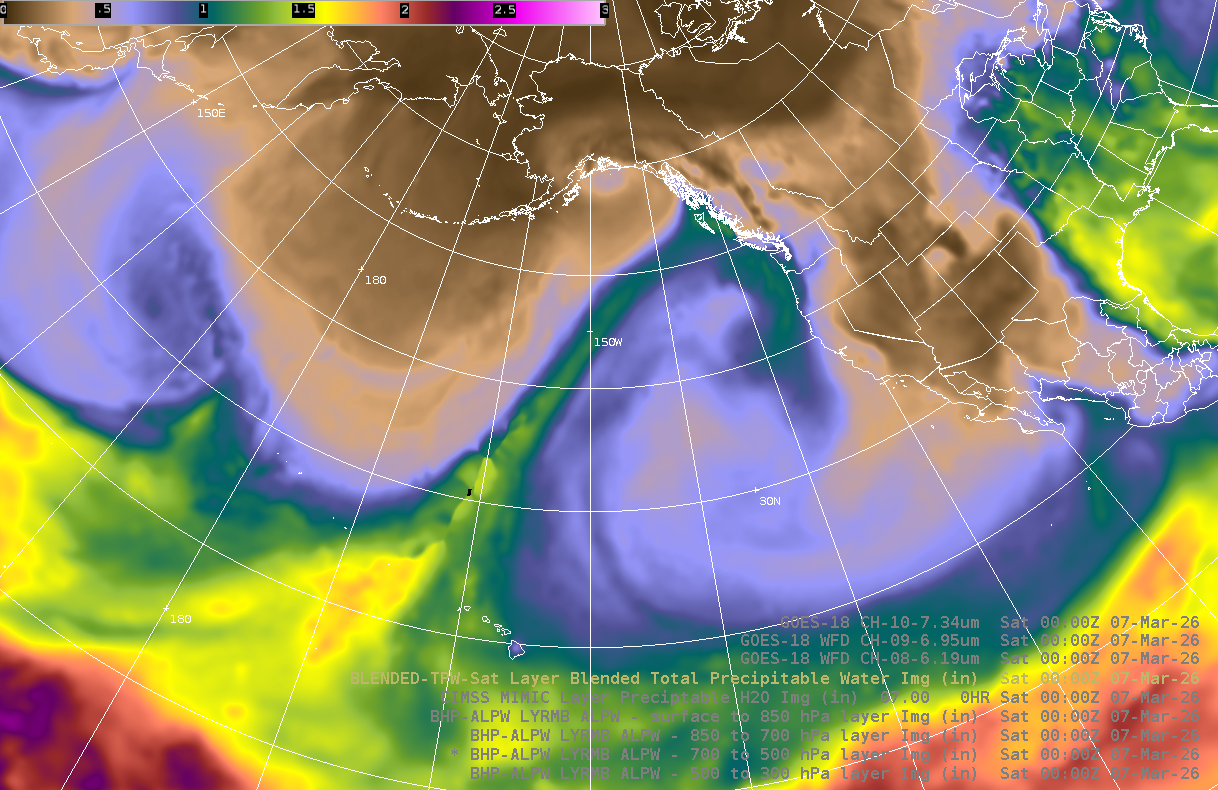
Advected Layered Precpitable Water (ALPW) products
The ALPW product offers a 4D structure of precipitable water in four vertical layers. Precipitable water values are not dependent on the model. Retrieval is done in clear and cloudy (not precipitating) regions.
ALPW 500-300mb 00Z 07 Mar 2026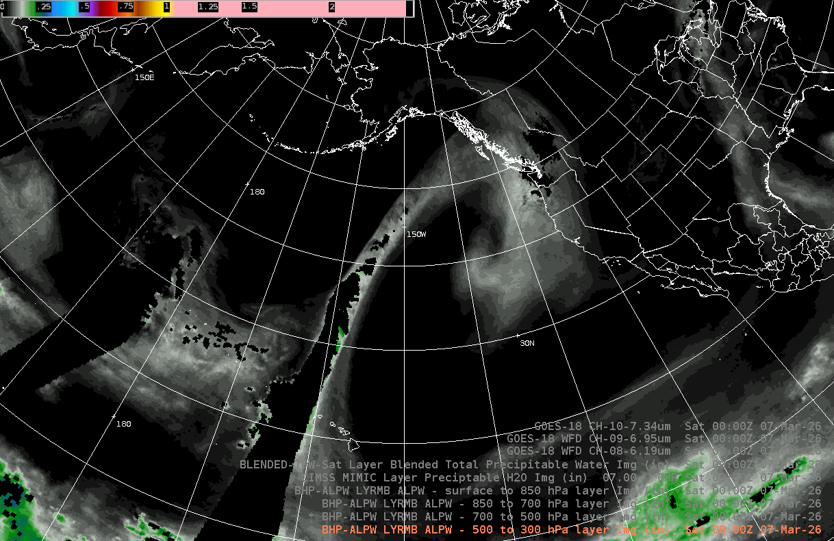 |
ALPW 700-500mb 00Z 07 Mar 2026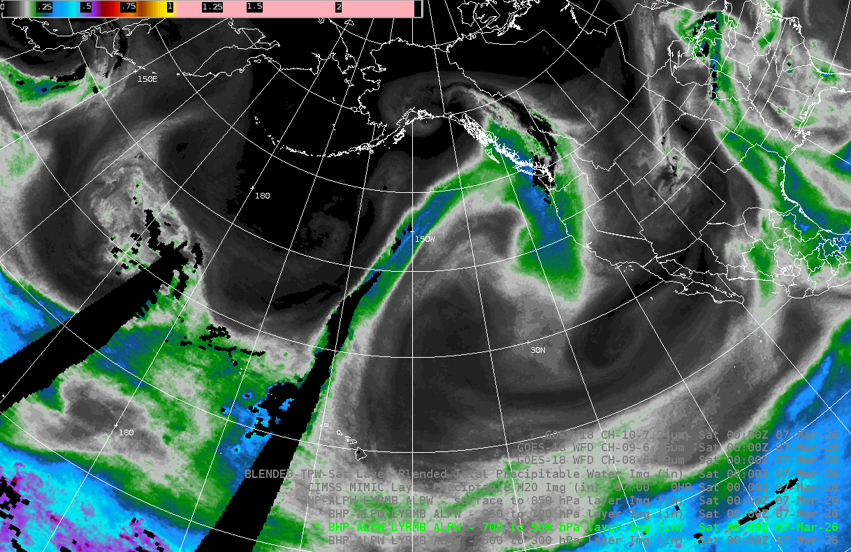 |
ALPW 850-700mb 00Z 07 Mar 2026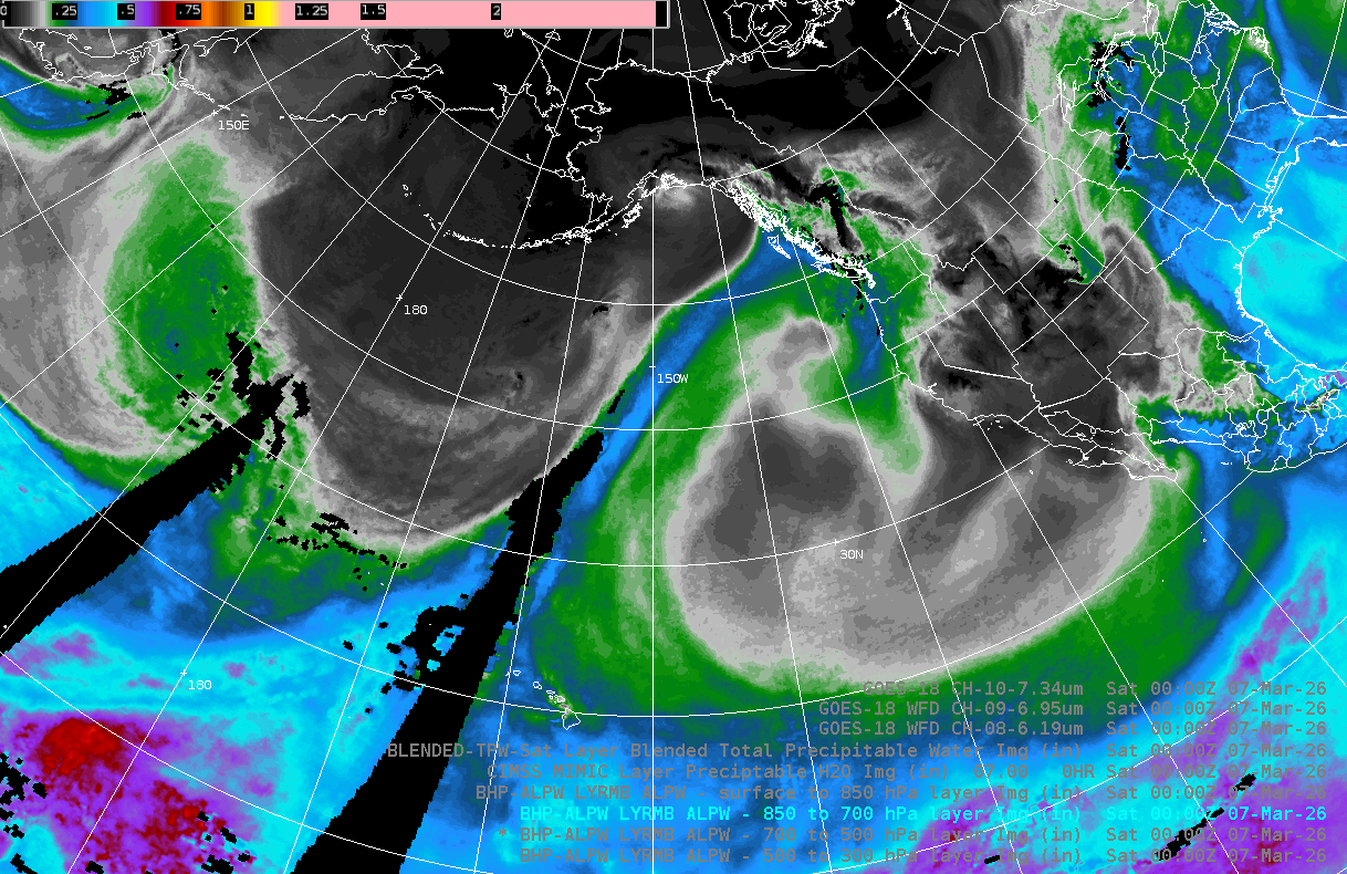 |
ALPW Sfc-850mb 00Z 07 Mar 2026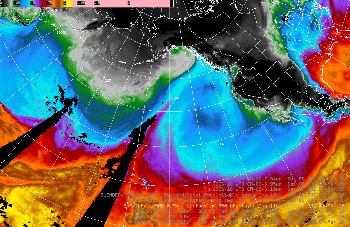 |
3. After examining the TPW and ALPW products, which of these statements is most correct?
- A. The moisture plume is concentrated mainly between 850 and 500 mb.
- B. A deep plume of moisture extends from near the surface to 300 mb.
- C. The moisture plume is mainly above 500 mb
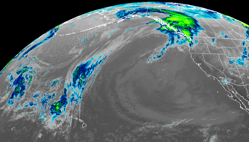
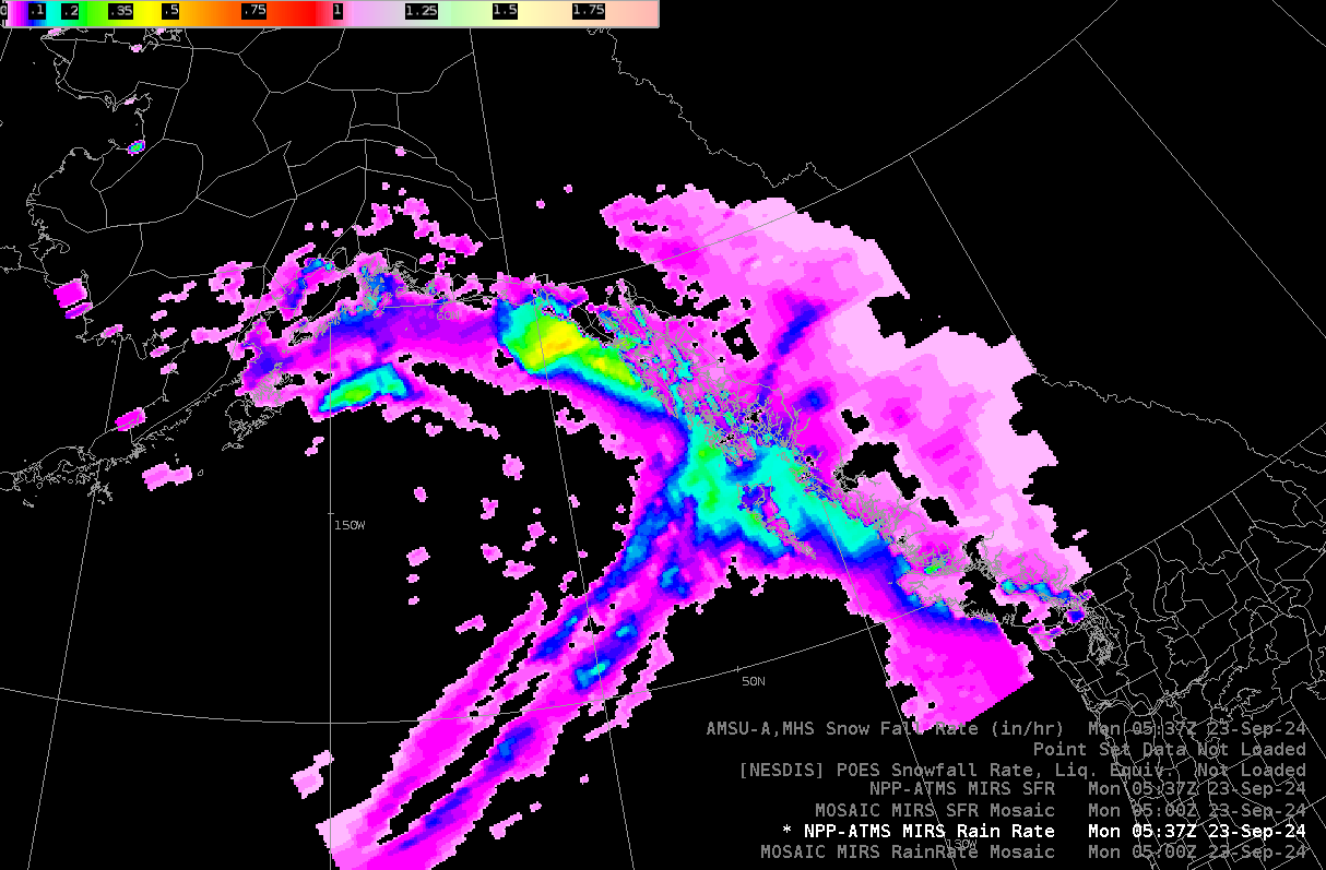
Below is a MiRS Rain Rate product showing rain rates with a front affecting southeast Alaska.
4. Knowing that rain rate estimates have a lower error threshold over water than over land, what amounts would be the best estimates for Juneau in the northern inner channels of southeast Alaska?
- A. .01 to .05 inches
- B. .05 to .10 inches
- C. .15 to .25 inches
- D. .50 inches or greater
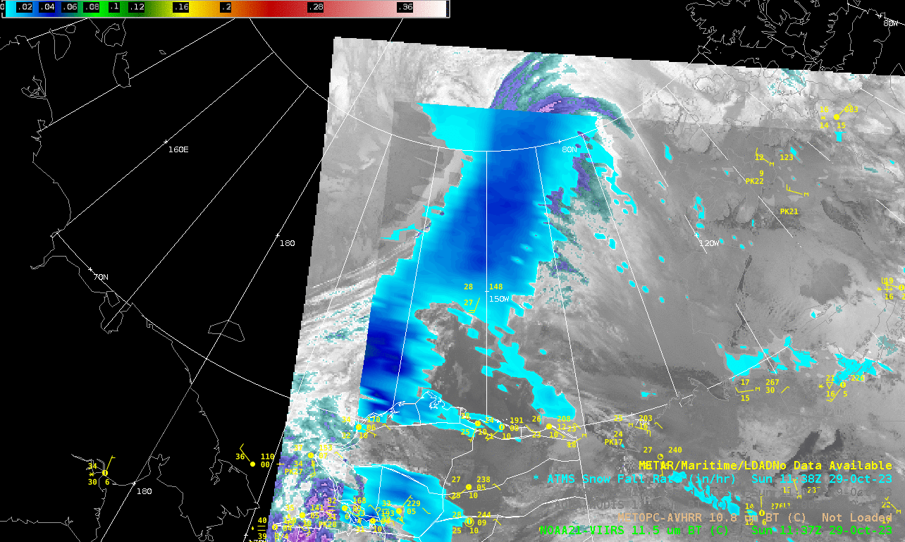
Animation of AK-SFR with a front over the Arctic Ice: 29 Oct 2023.
The AK-SFR product provides snowfall estimates over water and sea ice as well as land areas.
Rain and Snow over interior Alaska 26 Jan 2026
CMORPH2 Rain Rate 0500 UTC 26 Jan 2026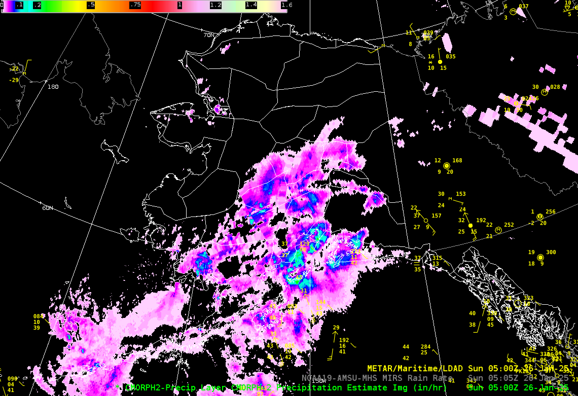 |
AK-SFR Snowfall Rate 0505 UTC 26 Jan 2026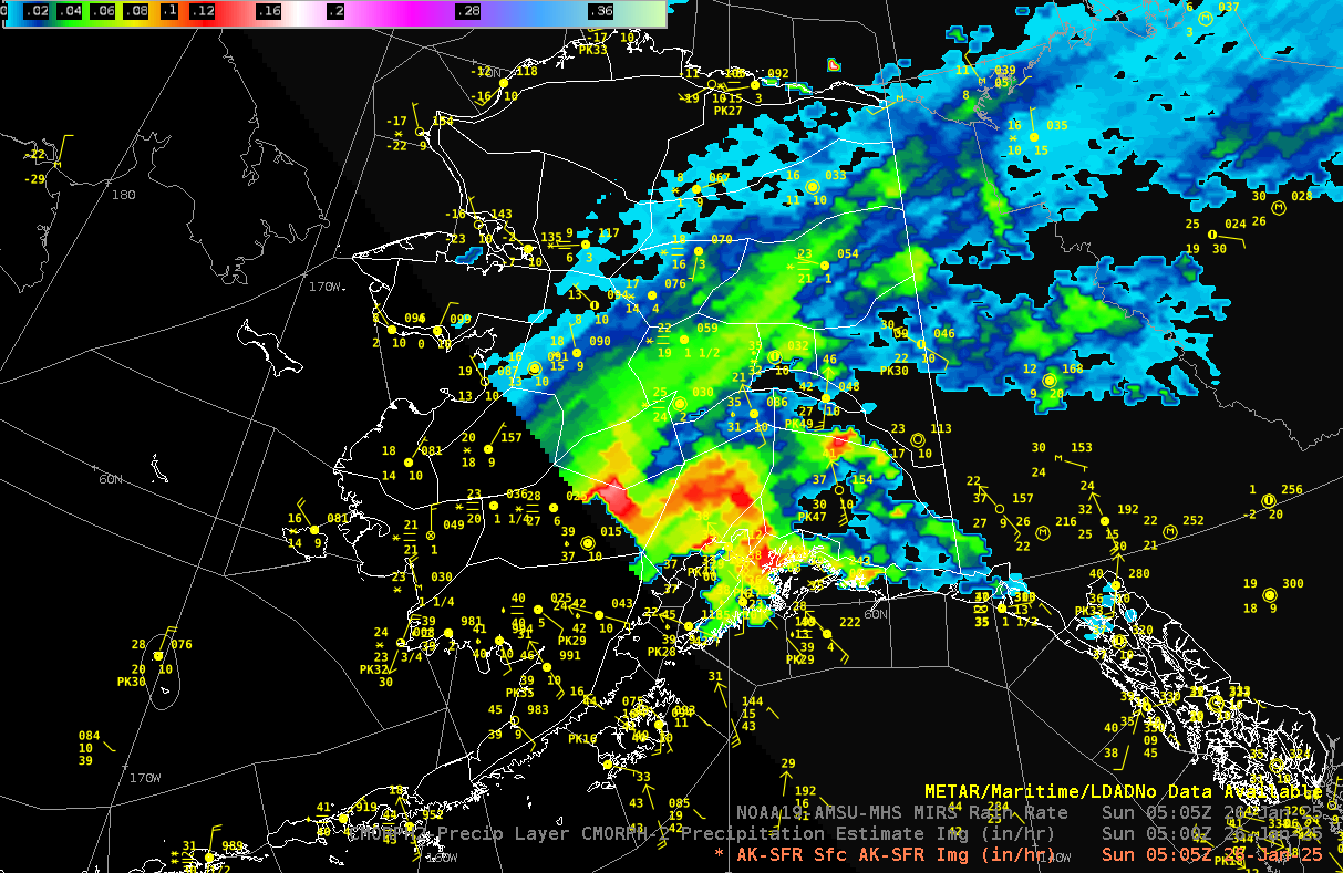 |
5. Referencing the CMORPH2 Rain rate and AK-SFR above, what can you say about the type of precipitation in the Fairbanks area?
- A. All rain
- B. All snow
- C. Primarily snow mixed with rain in the south
- D. Mixed rain and snow
Aircraft Icing Analysis - 15 Mar 2026
Cloud Liquid Water (CLW) is the total liquid water contained in a cloud in a vertical column of the atmosphere.
CLW 2134 UTC 15 Mar 2026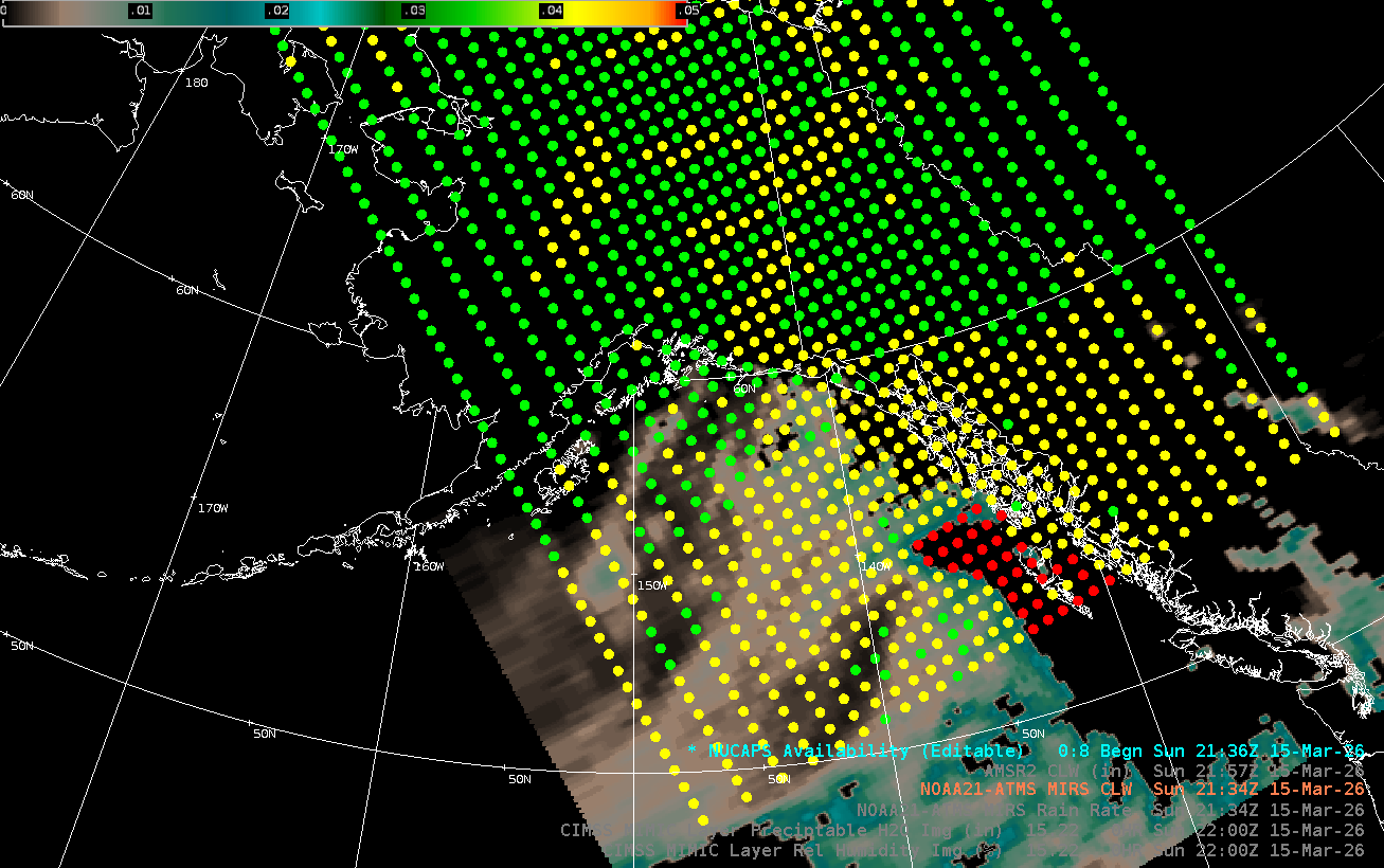 |
NUCAPS Skew-t 2137 UTC 15 Mar 2026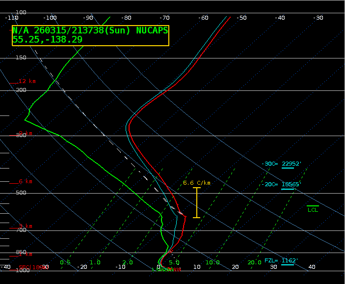 |
AMSR2 Ocean Winds
| AMSR2 Ocean Wind 1330Z 16 Sep 2022 |
AMSR2 Ocean Wind 1322Z 19 Oct 2023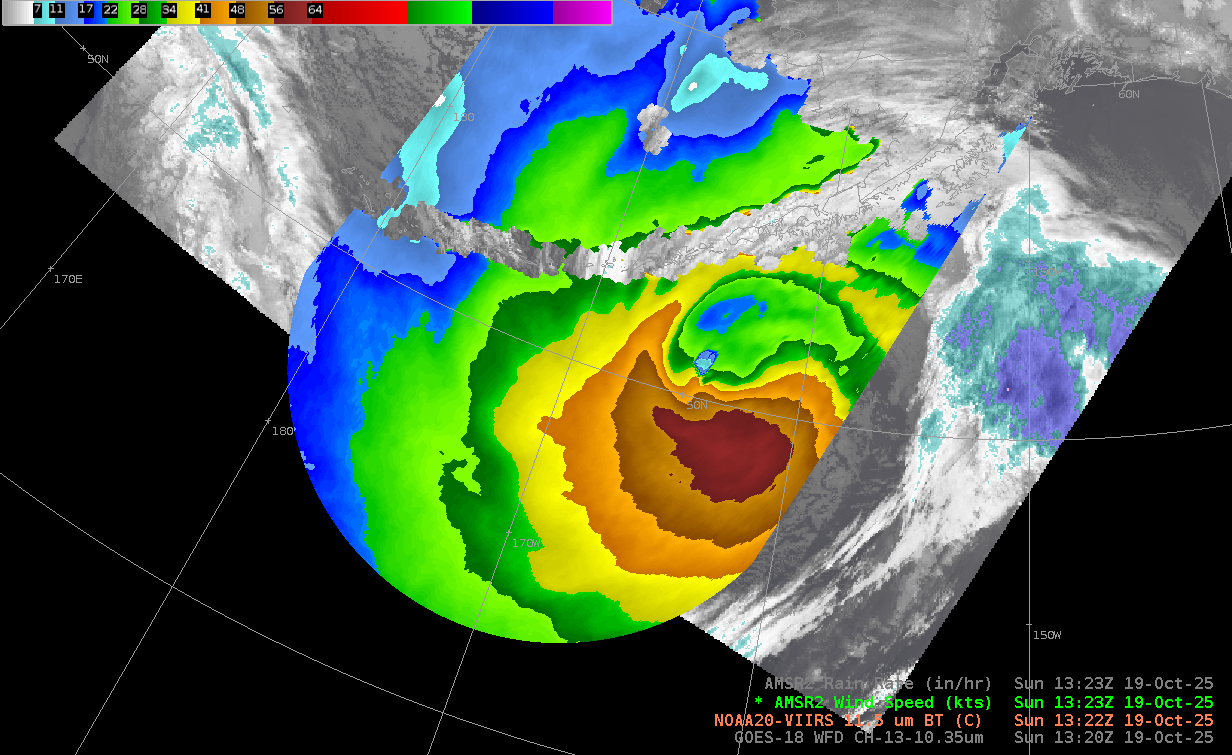 |
AMSR2 Ocean Wind 1241Z 12 Oct 2025
Ex-Typhoon Halong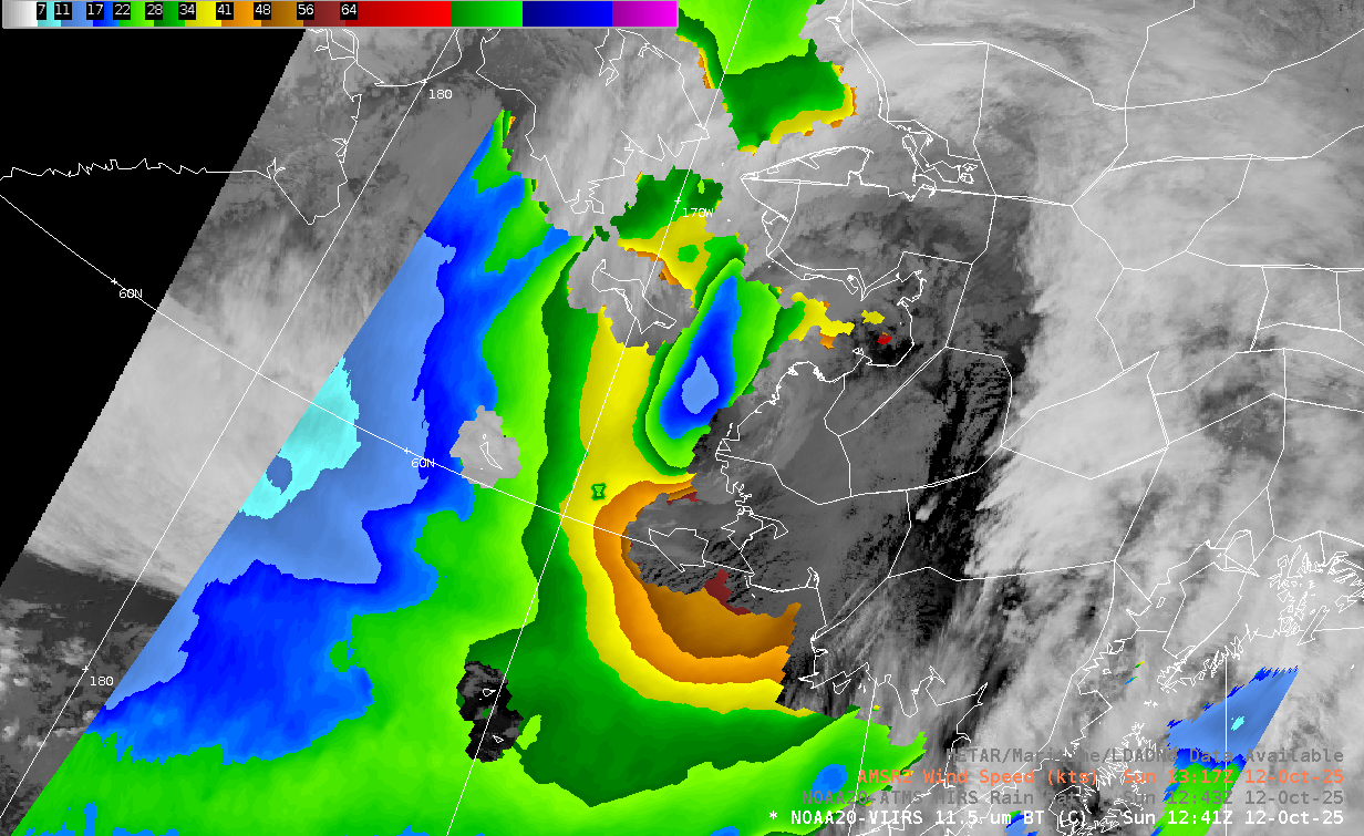 |
AMSR2 Ocean Wind 1352Z 03 Oct 2024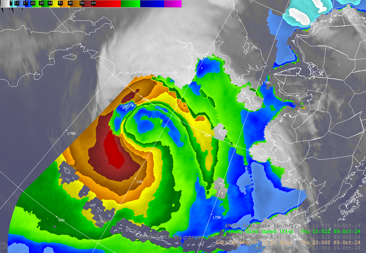 |
Other Microwave Products
Sea Ice Concentration Mosaic (MiRS) 10 Mar 2021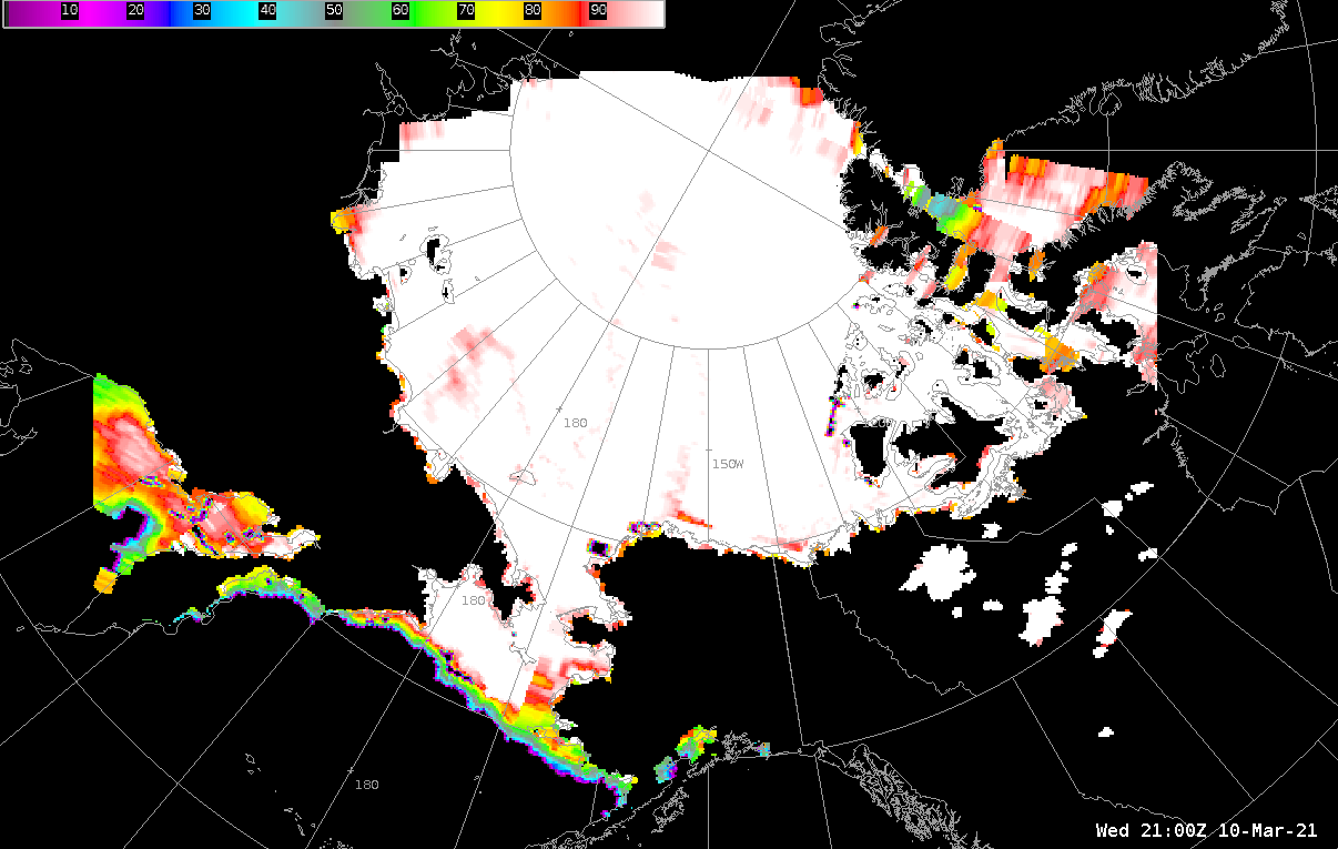 |
ATMS Snow Water Equivalent (SWE) 1253Z 05 Apr 2022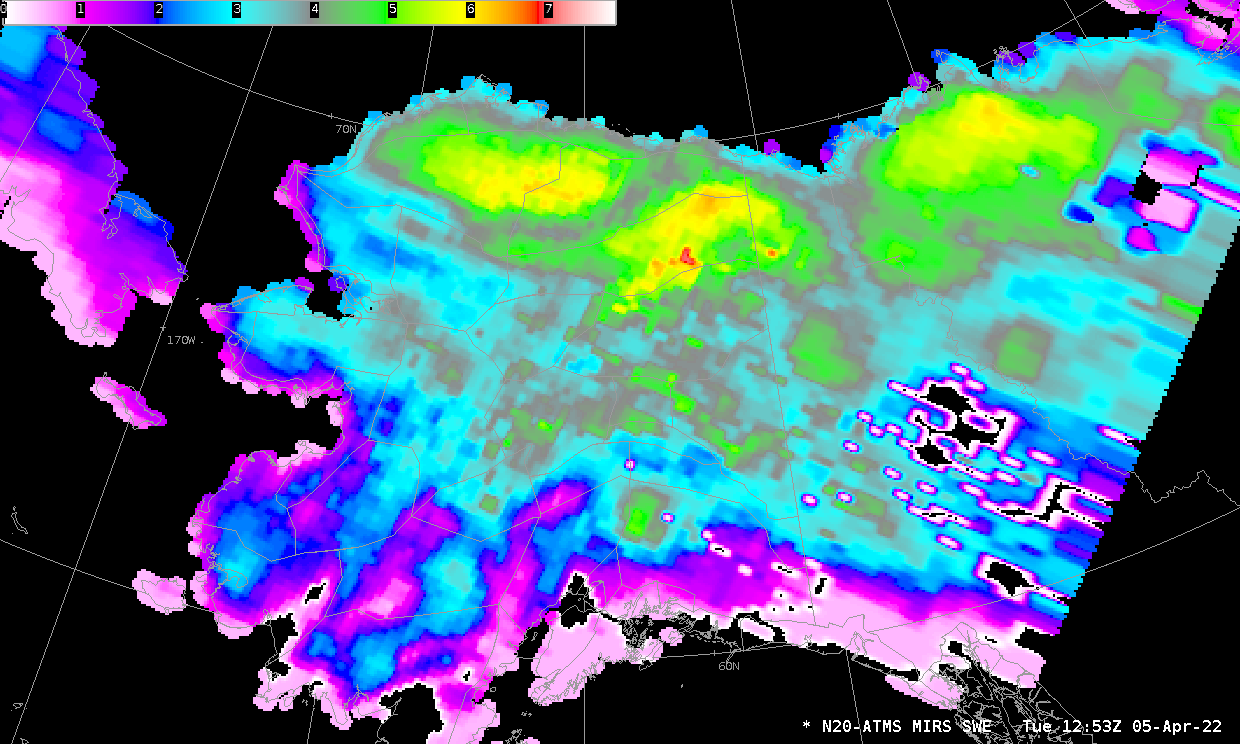 |
AMSR2 Sea Surface Temperature (SST) 2251Z 07 Oct 2020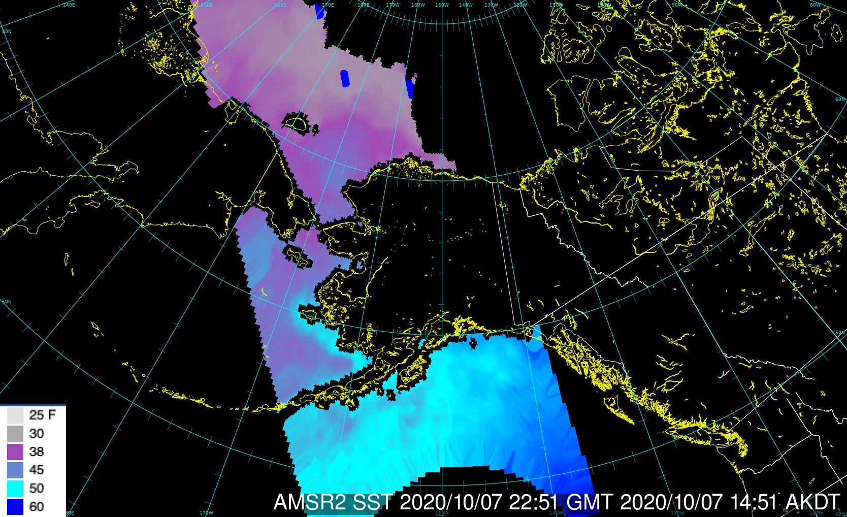 |
AMSR2 Composite Wind/Snow/SeaIce 0005Z 16 Jan 2021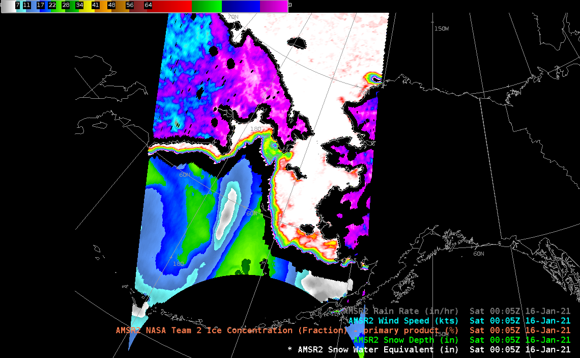 |